DREDGING AND BATHYMETRY MANAGEMENT

  • Client : ANP
  • Solution : Web-GIS 3D Application
  • Location : Morocco
  • Year : 2021
  • Subject : Design, Development, and Commissioning of a 3D Information System for Managing and Monitoring Dredging and Bathymetry Works

Challenges

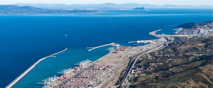
Managing and monitoring dredging and bathymetry works at over 37 ports presents significant challenges for ANP, including:

  • The complex management of a wide variety of specific data, often in substantial volumes
  • The need to use specialized software, high-performance computers, and qualified professionals to manipulate and analyze data
  • The absence of data centralization and standardization
  • Accessibility and usability difficulties for all involved parties, while ensuring reliability and performance of analyses

Solution

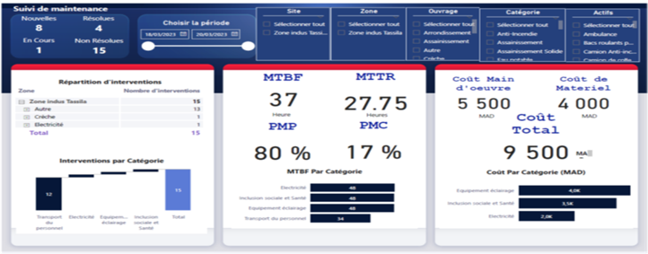
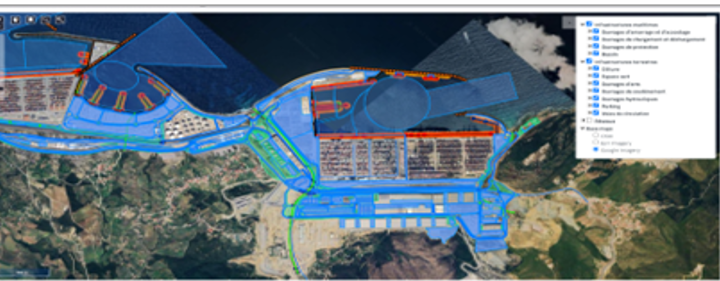
Deployment of an integrated Web-GIS 3D application dedicated to managing dredging and bathymetry works and point clouds. This solution enables:

  • The provision of advanced tools for data analysis, as well as reliable indicators to monitor changes in port basin depths
  • Automation of operational processes related to the supervision of dredging and bathymetry works
  • The ability to store, visualize, measure, and share all data associated with these processes efficiently

Services

Benchmarking, needs assessment and detailed design, development of the Web-GIS 3D system, data acquisition, and skills transfer